89 km
The first km’s today were on a signposted cycle route (as all days before). After the route turned to the north, I had to rely on, what naviki routed for me. Most time I found decent minor roads with nearly no traffic, not even cyclists. But thrice I had to pass an unannounced ford. I could avoid al times the bath in dirty water, because there was a narrow plank for pedestrians. Also some unpaved ways came across, one of them changed into a narrow single track through bushes. I had to dismount multiple times, but I could pass all ways an tracks with my extrawheel trailer. It surely was not good for normal trailers.
The first surprise on my route was Souvigny, a town and Monastery founded by the Cluny brotherhood. One big cathedral multiple other churches and chapels and other historical buildings.
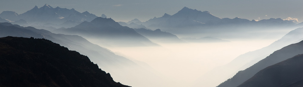
A next surprise was a view to the west after I reached 450 m height (coming from about 220 m)
A short rain shower I awaited dry under a tree. Down to Montluçon was rather steep and so was the climb to leave the town after crossing the river Cher.
This evening the camping really exists, but had my doubts, because the first official sign I detected, was only 100 m before the camping itself.
Paul
The first km’s today were on a signposted cycle route (as all days before). After the route turned to the north, I had to rely on, what naviki routed for me. Most time I found decent minor roads with nearly no traffic, not even cyclists. But thrice I had to pass an unannounced ford. I could avoid al times the bath in dirty water, because there was a narrow plank for pedestrians. Also some unpaved ways came across, one of them changed into a narrow single track through bushes. I had to dismount multiple times, but I could pass all ways an tracks with my extrawheel trailer. It surely was not good for normal trailers.
The first surprise on my route was Souvigny, a town and Monastery founded by the Cluny brotherhood. One big cathedral multiple other churches and chapels and other historical buildings.
A next surprise was a view to the west after I reached 450 m height (coming from about 220 m)
A short rain shower I awaited dry under a tree. Down to Montluçon was rather steep and so was the climb to leave the town after crossing the river Cher.
This evening the camping really exists, but had my doubts, because the first official sign I detected, was only 100 m before the camping itself.
Paul